How Drivers and Pilots Use GPS Navigation
We live in an age where getting lost is a choice, not a necessity. Whether you are driving a sedan to a new restaurant or piloting a Boeing 777 across the Atlantic, the same technology guides your journey. The Global Positioning System (GPS) has become the invisible thread connecting our movements, providing a level of precision and safety that was unimaginable just a few decades ago.
This process of using satellite data to calculate coordinates and velocity is the technical answer to what is gps navigation. Whether it is calculating a route to the grocery store or guiding an Airbus A380 to a smooth landing, the physics remain the same. The difference lies in how that data is processed, augmented, and presented to the human operator.
While the fundamental technology remains the same—satellites beaming time-stamped signals to receivers on Earth—the way drivers and pilots use this data differs significantly. This article explores these two distinct worlds of navigation, revealing how the blue dot on your phone relates to the complex flight computers in a cockpit.
The Driver's Perspective: Dynamic and Real-Time
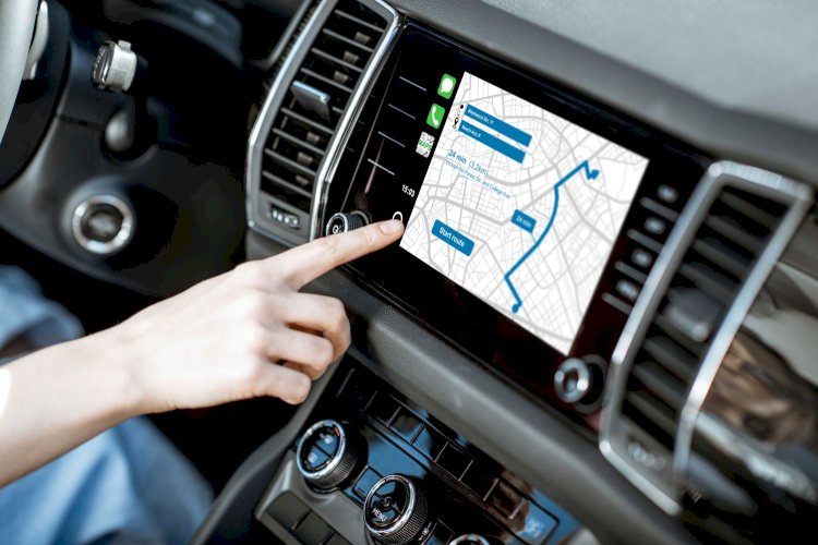
For most people, GPS is synonymous with the voice on their smartphone telling them to "turn left in 500 feet." In the automotive world, GPS has evolved from a static digital map into a dynamic, real-time assistant that actively manages the driving experience.
Beyond Simple Directions
In the early days of car navigation, GPS units were essentially digital versions of paper maps. They could tell you where you were and how to get to your destination, but they were blind to the changing world around them. Today, the modern driving experience is defined by connectivity.
When a driver inputs a destination, the system does not just look for the shortest distance. It analyzes traffic flow, road closures, and accidents. By aggregating data from millions of other users, navigation apps can predict traffic jams before they form and reroute drivers to side streets. This dynamic routing saves millions of hours of commute time and reduces fuel consumption globally.
Driver Assistance and Safety
GPS has also moved beyond the dashboard screen and into the car’s control systems. Advanced Driver Assistance Systems (ADAS) rely heavily on satellite positioning. Features like adaptive cruise control use GPS to anticipate curves in the road, slowing the car down automatically before the driver even touches the brake.
In the realm of autonomous vehicles, GPS is critical. While cameras and radar help a car see obstacles, high-precision GPS tells the car exactly which lane it is in and how that lane connects to the wider road network. This "localization" is essential for the safety of self-driving technology.
The Pilot's Perspective: Precision in Three Dimensions
While a driver might tolerate a GPS error of a few meters, a pilot often cannot. Aviation demands a level of reliability and integrity that goes far beyond consumer-grade electronics. For pilots, GPS is not just about finding a destination; it is about maintaining situational awareness in a three-dimensional space.
Area Navigation (RNAV)
Before GPS became standard, pilots navigated using ground-based radio beacons. They had to fly from one beacon to the next, often resulting in zig-zag flight paths. GPS revolutionized this by enabling "Area Navigation" (RNAV). This allows aircraft to fly direct routes between two points, regardless of where ground beacons are located.
This capability has transformed air travel. It allows for shorter flight times, significant fuel savings, and reduced carbon emissions. It also opens up airspace that was previously difficult to navigate, such as vast oceanic routes where ground-based signals cannot reach.
The Critical Phase: Approach and Landing
The most demanding phase of any flight is the landing, especially in poor weather. This is where aviation GPS truly shines. Modern systems use augmentation—such as the Wide Area Augmentation System (WAAS) in the US or EGNOS in Europe—to correct satellite errors and provide extreme accuracy.
This precision allows pilots to fly "GPS approaches." Even in thick fog or heavy rain, the flight computer can guide the plane down a virtual pathway in the sky, aligning it perfectly with the runway. This capability has increased safety margins and reduced the number of flights diverted due to bad weather.
The Infrastructure Behind the Journey
While we focus on the vehicles, we often overlook the infrastructure that makes these journeys possible. GPS plays a vital role in building the very roads and runways we travel on.
Engineering the Ground
In construction, GPS is used to guide heavy machinery with millimeter-level accuracy. Graders and bulldozers equipped with GPS receivers can sculpt the earth to exact specifications without manual staking or surveying. This ensures that highways are banked correctly for safety and that drainage systems work as intended.
The Core Technology: What Is GPS Navigation?
Despite the different applications, the underlying science is identical. A receiver captures signals from at least four satellites. It measures the time delay of the signal to calculate distance, then uses trilateration to determine position.
Conclusion
From the road to the sky, GPS has fundamentally changed how we move. For drivers, it has brought convenience and efficiency, turning every smartphone into a powerful co-pilot. For pilots, it has brought precision and safety, allowing for more direct routes and safer landings in difficult conditions.
As we look toward a future of autonomous cars and unmanned aerial vehicles, this reliance on satellite navigation will only deepen. The invisible network of satellites orbiting above us will continue to be the silent guide for every journey, no matter the vehicle or the destination.
What's Your Reaction?