Unleashing the Power of Precision: A Comprehensive Guide to Drone Mapping Services
In recent years, drone mapping services have revolutionized industries ranging from agriculture to construction, and everything in between. The ability to capture detailed aerial imagery and data, combined with advanced software tools for analysis, has made drone mapping an indispensable resource for professionals seeking to enhance productivity and decision-making.
What Are Drone Mapping Services?
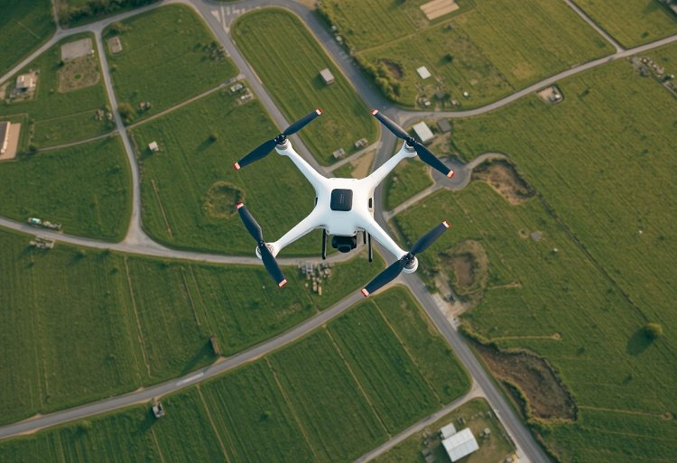
At its core, drone mapping services utilize unmanned aerial vehicles (UAVs) equipped with high-resolution cameras and sensors to collect aerial data over large areas. This data is then processed using specialized software to generate detailed maps and 3D models, providing users with accurate and timely information. This technology allows for various applications, including land surveying, monitoring natural resources, and assessing damage after disasters.
How it Works
-
Planning the Flight: To initiate a drone mapping project, the flight path must be meticulously planned. This involves selecting the area to be covered, the altitude for the desired resolution, and ensuring compliance with local regulations.
-
Data Collection: Using GPS technology, drones fly along predetermined paths, capturing images from multiple angles. High-quality cameras produce overlapping images, which are essential for creating accurate maps.
-
Data Processing: Once the images are collected, they are uploaded to mapping software that stitches the pictures together. Photogrammetry techniques transform the 2D images into 3D models, offering a comprehensive view of the surveyed area.
-
Analysis and Delivery: Finalized maps can include measurements, annotations, and other spatial data, delivered in various formats depending on the client’s needs, such as CAD files or GIS-compatible layers.
Benefits of Drone Mapping Services
1. Cost-Effectiveness
Traditionally, surveying large areas required expensive equipment and teams of personnel. Drone mapping services significantly reduce costs by minimizing manpower and time spent on-site.
2. Time Efficiency
What once took weeks can now be completed in hours. Drones can cover vast areas quickly, providing timely data for urgent projects, such as after a natural disaster.
3. High Accuracy and Precision
With the latest technology, drones can achieve centimeter-level accuracy. This precision is critical for projects requiring meticulous detail, such as construction planning or land surveying.
4. Enhanced Safety
Drones can safely access areas that may be hazardous for human workers, such as steep terrains or unstable structures. This capability allows for comprehensive data collection without risking lives.
5. Versatility
Drone mapping services can cater to a multitude of industries, including:
- Agriculture: Monitoring crop health and yield predictions.
- Construction: Tracking progress and managing resources.
- Real Estate: Providing high-quality aerial views for listings.
- Environmental Monitoring: Assessing forest health and wildlife habitats.
Applications of Drone Mapping
Agriculture
Farmers utilize drone mapping services for precision agriculture. Drones can generate NDVI (Normalized Difference Vegetation Index) maps, which help in assessing plant health, water stress, and yield predictions. This data leads to better resource management and productivity.
Construction
In the construction industry, drone mapping services allow for effective project management. Construction managers can track the progress of their sites, oversee material delivery, and ensure safety compliance. Aerial images serve as a historical reference for project timelines.
Environmental Conservation
Drone mapping is pivotal in environmental studies. Organizations use drones to monitor wildlife populations, assess habitat destruction, and track changes in landscapes over time. This information is essential for conservation efforts and policy-making.
Infrastructure Inspection
Drones provide a cost-effective method for inspecting infrastructure, such as bridges, pipelines, and power lines. Their ability to capture difficult angles reduces the need for scaffolding or climbing, thereby enhancing safety.
FAQs About Drone Mapping Services
Q1: How accurate are drone mapping services?
A: Drone mapping services can achieve accuracy levels of up to 1-3 centimeters, depending on the equipment used and the processing techniques applied.
Q2: What industries benefit the most from drone mapping services?
A: Industries such as agriculture, construction, real estate, environmental monitoring, and utilities are among the primary beneficiaries of drone mapping services due to its versatility in data collection and analysis.
Q3: Is it legal to operate a drone for mapping purposes?
A: Yes, but it depends on local regulations. Operators must typically obtain specific licenses, adhere to airspace restrictions, and ensure safety protocols. It’s essential to consult local laws before conducting any drone operations.
Q4: How long does it take to receive the final maps?
A: The duration varies depending on the project scope and size. Small mapping projects may be ready within days, while larger, more complex projects might take weeks to process.
Q5: What types of data can be collected through drone mapping?
A: Drone mapping can collect various data types, including high-resolution images, elevation data, thermal imaging, and multispectral images. Each of these data types serves different purposes across industries.
Conclusion
Drone mapping services represent a significant leap forward in the way data is collected and analyzed across various sectors. Businesses adopting this technology stand to gain a competitive edge through enhanced accuracy, efficiency, and cost-effectiveness. As technology continues to evolve, so too will the capabilities and applications of drone mapping, shaping the future of spatial data analysis.
Whether you’re a farmer looking to optimize your crops, a construction manager tracking project developments, or an environmentalist advocating for conservation, drone mapping services are harnessing the power of technology to deliver precise and actionable insights. Investing in these services not only revolutionizes data gathering but also enhances decision-making processes in an increasingly data-driven world.
What's Your Reaction?